
How GPS Works: A Simple Guide to Global Positioning Systems
Chances are you’ve used GPS today without even realizing it. Whether checking traffic before leaving home or using a map and direction tool in your browser, GPS has become so embedded in our online navigation experience that we seldom stop to think about how it actually works. If you’ve ever wondered what makes that blue dot move on your digital map or how your route updates in real-time, this article has you covered.
In this simple guide, we’ll break down how Global Positioning Systems (GPS) function—without the technical jargon—and explain how this technology powers your favorite browser-based maps right inside your extension.
What Is GPS, Really?
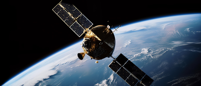
GPS stands for Global Positioning System. It’s a network of satellites orbiting the Earth, originally developed by the United States Department of Defense. Today, it’s used by millions of civilians around the world—for everything from ride-hailing apps to browser-based navigation. These satellites send out signals that help determine your exact location on the planet, often within a few feet.
Your smartphone, laptop, or device uses these signals to “triangulate” your position. In most browser extensions that offer maps and route tools, your location is accessed either via IP address (which gives a rough idea of your location) or more precisely, through your device’s GPS receiver.
How Signal Triangulation Works
The underlying principle behind GPS is simple but powerful: it relies on time and distance. Each GPS satellite in orbit constantly broadcasts a signal that includes its location and the exact time the signal was sent. Your device receives these signals from multiple satellites—ideally four or more—and calculates how long each signal took to arrive.
Since radio waves travel at the speed of light, your device uses this time delay to figure out how far away each satellite is. By comparing signals from multiple points, the system triangulates your position in three-dimensional space: latitude, longitude, and altitude.
In a browser-based map extension, this data is relayed almost instantly, allowing your current location to appear on the map and be used to generate step-by-step directions.
What About Real-Time Traffic and Rerouting?
GPS by itself can only tell you where you are, not how fast traffic is moving nearby. But when combined with mobile data and crowd-sourced reporting, your browser extension can display live traffic overlays, alternate routes, and estimated arrival times. This real-time information adds a dynamic layer to what used to be simple static maps.
Is GPS Always Accurate?
While today’s GPS accuracy is impressive, it’s not infallible. Your location can be affected by obstacles like buildings, tunnels, or electronic interference. That’s why your browser extension may occasionally require a refresh or need permission updates to access your current location again. In general, with four or more satellites in range, civilian GPS can offer location accuracy within about 5–10 meters.
Final Thoughts
The next time you use a digital map or get directions via a browser extension, it’s worth appreciating the global satellite network working in the background. GPS may be invisible, but it’s a complex, elegant technology that makes online navigation possible. Whether you’re searching for the nearest gas station or planning a road trip, it’s the unseen driving force behind your browser-based route finder.
So while the “blue dot” on your map may seem simple, the tech behind it is anything but—and it’s only getting smarter.