
Top Features of Modern Digital Maps: What Makes Them Essential Tools Today
Digital maps have come a long way from static displays of roads and landmarks. What was once a simple navigation aid has transformed into a powerful, interactive tool used across countless industries—from travel and logistics to urban planning and disaster response. But what exactly sets modern digital maps apart from their traditional counterparts? In this article, we explore the top features of modern digital maps and how they enhance everyday decision-making and efficiency.
These advancements go beyond convenience; they’ve fundamentally changed how we move through the world.
1. Real-Time Traffic and Route Updates
One of the most significant improvements in today’s mapping technology is the integration of real-time data. Digital maps offer live traffic updates, helping drivers avoid congested routes, accidents, or road closures.
By analyzing data from satellites, sensors, and user input, maps can suggest alternate routes instantly. For commuters and delivery drivers alike, this feature saves time, money, and stress.
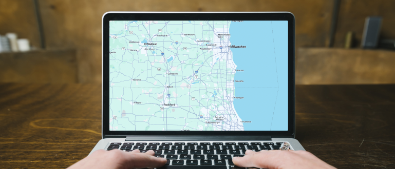
2. Satellite and Street View Imagery
Modern digital maps offer multiple viewing modes. Satellite view provides a bird’s-eye perspective, making it easier to understand terrain and surroundings, while Street View delivers ground-level imagery so users can preview specific locations as they appear in reality.
This blend of visual information enhances navigation, makes identifying landmarks easier, and assists users in planning realistic travel or meeting points.
3. Location Sharing and Geolocation
One of the most convenient features of modern digital maps is the power to share your location in real-time. Whether you’re meeting friends at a crowded park or waiting for an Uber pickup, geolocation technology ensures accurate pins and allows users to track a location’s movement.
For safety and convenience, location sharing is a valuable feature that applies across personal, business, and emergency use cases.
4. Customization and Layers
Modern digital maps allow for remarkable customization. Users can switch between different layers—such as topography, bike trails, or public transit routes, — to get a more tailored view of their destination or area of interest.
Businesses and developers, for instance, use custom map layers to display real estate listings, property boundaries, and infrastructure layouts, while outdoor enthusiasts rely on terrain views for optimal hiking routes.
5. Points of Interest and Business Integration
Today’s maps are more than navigation tools—they double as local guides. Whether you’re searching for the nearest coffee shop, a gas station, or a five-star restaurant, digital maps offer extensive details all in one spot.
Conclusion
The features of modern digital maps go far beyond plotting points or calculating distances. They are intelligent, adaptive, and deeply integrated into daily life—offering real-time information, seamless navigation, dynamic customization, and even safety insights.
For travelers, commuters, businesses, and everyday users alike, digital maps have become essential tools that continue to evolve. As technology expands, we can only expect tomorrow’s maps to be even smarter, more interactive, and more indispensable.